
The ground, drawn and measured.
Half the name is Land, and it isn't decoration. Every property you run — owned, leased, or the forty acres across the road — sits on one map, with the pastures, pens and gates inside it drawn where they actually are.
Draw it once, on satellite imagery
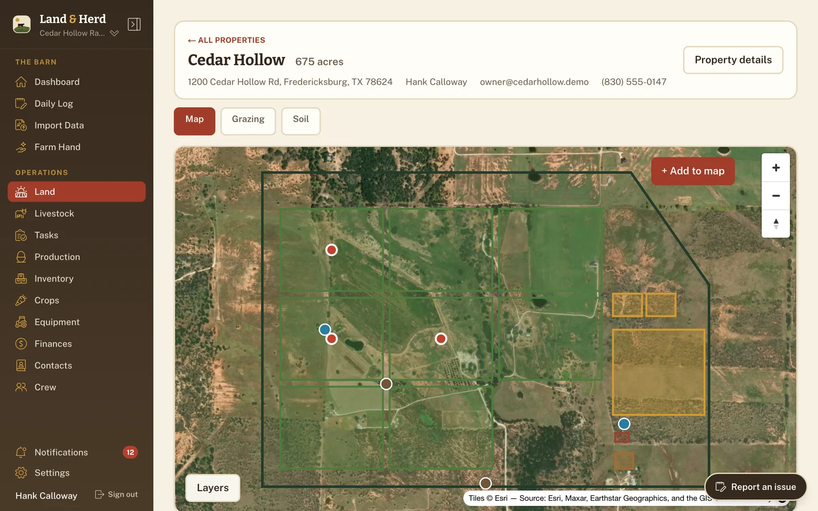
Land opens on a satellite basemap. Trace a property's boundary and the acreage comes from the shape — no deed to squint at, no arithmetic. Then draw what's inside it:
- Pastures — the paddocks (fenced grazing sections) the rotation runs on.
- Pens and fields — the working lots and the cropped ground.
- Barns — the buildings that matter to whoever's looking for them.
- Water points and gates — dropped as points, because a tank isn't an area.
- Boundaries — fence lines and divisions that aren't a paddock in themselves.
Every area feature carries its own acreage, in acres or hectares — your choice, set once for the ranch. A pasture with animals in it shows its stocking rate the way you'd say it out loud: 0.25 head per acre.
More than one place, without more than one account
Plenty of operations aren't one block of ground. The home place, the leased quarter, the piece your father-in-law still calls his — each is a property with its own map, its own address, and the owner's name, email and phone on the card, which is the detail you want at hand when a lease is up. The list shows each one's acreage and how many features are drawn on it.
How many properties you can run depends on the plan: one on Free and Homestead, three on Ranch, and as many as you need on Operation. The pricing page lays that out →
Open a property and it has tabs, not pages
Inside a property, the same ground answers three different questions. Map is what's drawn. Grazing is the rotation — what's ready, what's resting, how many days to go. Soil is the USDA's survey of what's underneath. One header, one acreage, three ways of looking at it.
A paddock doesn't have to be drawn to be real
Mapping the whole place is an afternoon, and not everybody has the afternoon. A pasture needs a name and a rest period to join the rotation — that's it. Draw it later, when you're sitting down anyway, and the shape attaches to the record you've already been using. Nothing waits on cartography.
It's there on every plan
Land isn't a paid extra or a module you switch on. It's in the sidebar the day you create your ranch, on the free plan like every other. Switching Pastures off takes the Grazing view away — the map stays.
What this connects to
Soil survey
What the USDA has already mapped under your ground — soils, slope, and what it will take to work.
Soil survey →Rotational grazing
Rest periods, ready alerts, and moving the herd from one paddock to the next in one action.
Rotational grazing →Documents & export
A printable soil report for a lender or a leaseholder, and every other record on its way out.
Documents & export →Put the place on a map
Set up your ranch in a couple of minutes and draw the first property. Trace one boundary and the acreage works itself out. A paddock doesn't even have to be drawn to join the rotation.